

|
Wabakimi Maps & Store
|
(Please place download orders separately from print orders--to get the download link Immediately) |
FOW's Online payment platform is now Affinipay.
An important announcement from Laurence Mills, Wabakimimaps.com: “We have joined forces with Friends of Wabakimi and are offering our maps on their website in support of their mission to protect and conserve this incomparable wilderness canoeing region. We have incorporated data from all of the sources available to us ensuring that our canoe route maps are the most comprehensive and informative. Downloadable PDF Each canoe route map set can be purchased as a downloadable PDF from the Friends of Wabakimi store: Here's a directory for lakes/waterways in each map set. Laminated (waterproof). Laminated waterproof canoe route map sets will continue to be available on www.wabakimimaps.com” ----------------------------------------------- The Map Store is Open! This will take you to our Wild Apricot interactive site. If you are a FOW member, go ahead and enter your email address. Likely you'll need to set your password to enter our membership system. Once logged in, you access the member pricing. If you're not yet a member, please Join Us first. While you're logged in (as either a member or a contact) feel free to update your Profile in this system. Any questions, drop us an email at [email protected]. We're still working on this, so comments and suggestions are welcome. Remember, our prices are in Canadian! $1 u.s. = $.1.29 C.AD or conversely, $.73 CAD = $1 U.S. (exchange rate subject to change) 
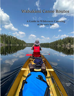
Wabakimi Canoe Routes Guidebook
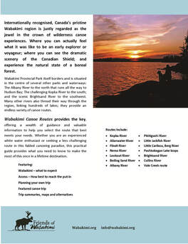
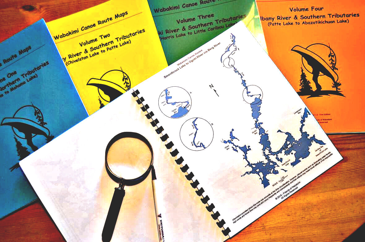
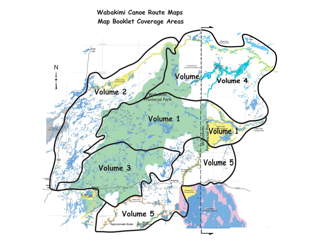
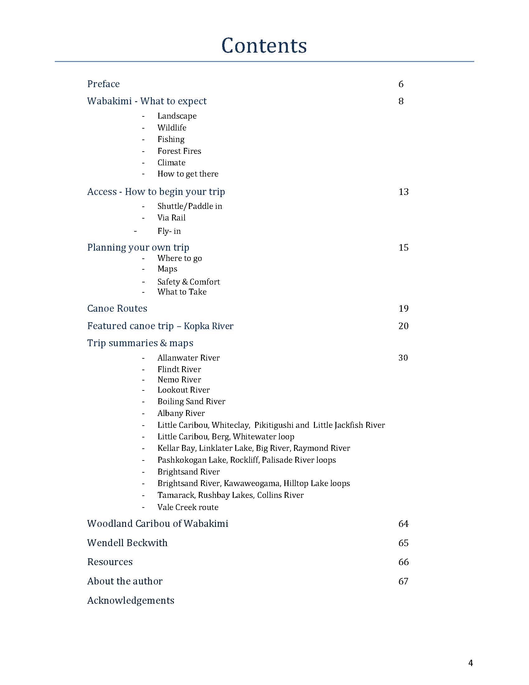
Laurence Mills, author The very first Guidebook for Wabakimi Provincial Park and surrounding parks; conservation reserves and Crown lands; all with networks of historic canoe routes. Laurence Mills has spend decades exploring this area and producing his own line of excellent route maps (www.wabakimimaps.com). He is a FOW member and worked closely with our Guidebook Committee. Wabakimi Canoe Routes provides a wealth of valuable information to help you select the route that best meets your needs. Whether you are an experienced white water enthusiast or seeking a less challenging route in this fabled canoeing paradise; this practical guide provides what you need to know to make the most of this once in a lifetime destination. (Guidebook Contents) Featuring: * Wabakimi – what to expect * Access – How best to reach the put-in * Planning your own trip * Featured canoe trip (Kopka River) * Trip summaries, maps and alternatives Wabakimi Canoe Route Maps Volumes I-V Sets of canoe route maps are bound in five separate volumes according to their location in a particular watershed as depicted here. Each volume contains a table of contents, a coverage map showing the routes included and detailed information. These were produced by The Wabakimi Project (2004-2018). Our big Planning Map covers it all! |

|
about the mapsWabakimi Canoe Route Volumes
These route maps are the result of The Wabakimi Project expeditions from 2004 to 2018.
Volumes are bound in separate volumes according to their location in a particular watershed and are designed to be taken into the field to complement the use of 1:50,000 NTS topographical maps. Each map is produced in full colour on high quality 8.5" x 11.0" paper and is assigned a descriptive title that indicates the extent of coverage and the direction of flow of the main intervening waterway. Canoe route values such as campsites and portages are shown. Accurately measured portage lengths are expressed in metres to make them compatible with topo maps. Locations of outpost camps and lodges are included where assistance may be obtained should an emergency arise. The maps are uniform in scale and each overlaps adjoining maps for seamless coverage of a canoe route. Enlargement circles provide magnified details of portages as well as hazards or obstacles such as swifts, rapids and waterfalls. Detailed MAP DESCRIPTIONS |
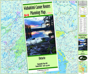
Wabakimi Canoe Routes Planning Map
UPDATED Feb. 2023 Originally produced by “Uncle” Phil Cotton this is the only map that depicts all known canoe routes in the greater Wabakimi Area, which includes Wabakimi Provincial Park; surrounding parks and Crown Lands in a readable scale of 1:250,000. The map is 35" tall x 41.5" wide and covers over 43,000 square kilometers (16,500 square miles) of pristine wilderness.
NEW in Feb. 2023! Updated Planning Map, has all the features of Phil's map, but also now has entry points; maintained routes along with historic routes; outposts and train stops. Developed anew by GoTrekker Maps; we can make updates to this map as needed. Information about primary and secondary heights of land; lakes and rivers and provincial park and conservation reserve boundaries are drawn from the Ontario Ministry of Natural Resources (OMNR) data set. Grid lines every 30 minutes of longitude and every 15 minutes of latitude define the coverage of the 1:50000 Provincial Series of topographical maps over the entire extent of the map. Topo map index numbers are provided at the grid intersection points. It is ideal for planning a canoe trip, as a conversation piece to recollect memories of past adventures or as the perfect gift for the consummate wilderness paddler in search of new canoeing opportunities. 
|
|
|
|
|
|
|
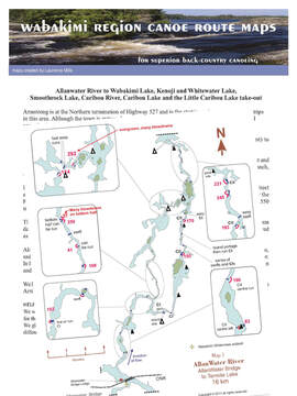
Volume One 1. Savant Lake to Tew Lake via Ogoki River 2. Tew Lake to Lower Wabakimi Lake via Ogoki River 3. Wabakimi Lake to Whitewater Lake via Ogoki River 4. Wabakimi Lake to Smoothrock Lake via Lower Wabakimi Lake 5. Smoothrock Lake to Ogoki River via Berg River 6. Smoothrock Lake to Whitewater Lake via McKinley River 7. Whitewater Lake 8. Whitewater Lake to Whiteclay Lake via Ogoki River 9. Whiteclay Lake to Ogoki Reservoir via Ogoki River 10. Ogoki Reservoir to Mojikit Channel 11. Ogoki Reservoir to Mojikit Lake via Mojikit Channel 12. Ogoki Reservoir to Mahamo Lake via Ogoki River 13. Davies Lake to Ahleen Lake via Palisade River 14. Rockcliff Lake to Palisade River via Webster Creek 15. Webster Lake to Ahleen Lake via Corky Creek 16. Ahleen Lake to Kenoji Lake via Palisade River 17. Kenoji Lake to Whitewater Lake via Grayson River 18. Dawn Lake to Arril Lake via Dawn Creek 19. Dawn Lake to Slim Lake via Slim River |
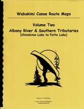
Volume Two 1. Chivelston Lake to Savant Lake via Harold Lake 2. Smye Lake to Savant Lake via Jutten Lake 3. Smye Lake to Savant Lake via Kneehigh Lake 4. Virginian Lake to Savant Lake via Virginian Creek 5. Savant Lake South 6. Savant Lake North 7. Savant Lake to Velos Lake via Savant River 8. Savant Lake to Velos Lake via Little Savant River 9. Jabez Lake to McCrea Lake via McCrea Creek 10. Velos Lake to East Pashkokogan Lake via Savant River 11. Little Savant River to Davies Lake via Redmond Creek 12. Takeoff Lake to McCrea Lake via Shoe Lake 13. Fitchie Lake to Savant Lake via Neverfreeze Creek 14. Fitchie Lake to Minchin Lake via Little Pashkokogan River 15. Fitchie Lake to Minchin Lake via Pashkokogan River 16. Minchin Lake to Pashkokogan Lake via Pashkokogan River 17. Pashkokogan Lake to Osnaburgh Lake via Pashkokogan River 18. Osnaburgh Lake to Atikokiwam Lake via Albany River 19. Atikokiwam Lake to Achapi Lake via Albany River 20. Achapi Lake to Patte Lake via Albany River - Part One 21. Achapi Lake to Patte Lake via Albany River - Part Two 22. Pashkokogan Lake to Rockcliff Lake via Misehkow River 23. Rockcliff Lake to Blow Lake via Misehkow River 24. Blow Lake to Albany River via Misehkow River - Part One 25. Blow Lake to Albany River via Misehkow River - Part Two 26. Early Lake to Misehkow River via Coles Lake |
|
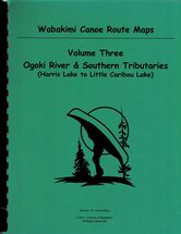
Volume Three
1. Harris Lake to Heathcote Lake via Neston Lake
2. Heathcote Lake to Wilkie Lake via Smye Lake 3. Heathcote Lake to Flindt Lake via Flindt River 4. Flindt Lake to Tew Lake via Flindt River 5. Heathcote Lake to Allanwater Bridge via Barrington Lake 6. Allanwater Bridge to Termite Lake via Allan Water River 7. Flindt Lake to Brennan Lake via Gault Lake 8. Brennan Lake to Granite Lake via Allan Water River 9. Granite Lake to Wabakimi Lake via Allan Water River 10. Redhead Lake to Brennan Lake via Nemo River 11. Snake Lake to Brennan Lake via Jeep Lake 12. Dagger Lake to Granite Lake via Otter Bluff Lake 13. Granite Lake to Lower Wabakimi Lake via McWade Lake 14. Elf Lake to Smoothrock Lake via South Lake 15. Baldhead Lake to Onamakawash Lake via Lookout River 16. Onamakawash Lake to Smoothrock Lake via Lookout River 17. Collins Lake to Smoothrock Lake via Boiling Sand River 18. Collins Lake to Tempest Lake via Shawanabis Lake 19. Maggotte Lake to Shawanabis Lake via Boulder Lake 20. Tew Lake to Lower Wabakimi Lake via Ogoki River 21. Wabakimi Lake to Smoothrock Lake via Lower Wabakimi Lake 22. Little Caribou Lake to Caribou River via Caribou Lake 23. Caribou Lake to Smoothrock Lake via Caribou River 24. Caribou Lake (Outlet Bay) to Caribou Lake (Brockway Bay) via Brockway Lake |
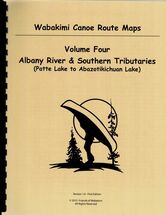
Volume Four
1. Patte Lake to Miminiska Lake via Albany River
2. Miminiska Lake to Petawanga Lake via Albany River 3. Petawanga Lake to Triangular Lake via Albany River 4. Triangular Lake to Abizotikichuan Lake via Albany River 5. Shabuskwia Lake to Patte Lake via Shabuskwia River 6. Misehkow River to Shabuskwia River via Greenmantle River 7. Shabuskwia Lake 8. Shabuskwia Lake to Luella Lake Lake via Kilbarry Lake 9. Luella Lake to Attwood Lake via Attwood River 10. Attwood Lake to Peninsular Lake via Attwood River 11. Peninsular Lake to Triangular Lake (Gowie Bay) via Albany River 12. Peninsular Lake to Kellow Lake via Cat Tail River 13. Kellow Lake to Abizotikichuan Lake via Opichuan River 14. Kagianagami Lake to Kellow Lake via Opichuan River 15. Kagianagami Lake (Humble Bay) to Elbow Lake via Muskrat Lake 16. Mahamo Lake to Kagianagami Lake via Opichuan River 17. Whiteclay Lake to Grinch Lake via Witchwood River 18. Grinch Lake to Hurst Lake via Witchwood River 19. Attwood Lake to Petawanga Lake via Petawa Creek 20. Eabamet Lake to Triangular Lake via Eabamet River |
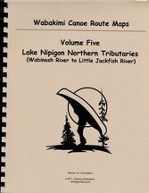
Volume Five
Updated Maps 4, 5, 9, 12 & 13 (free download)
Volume Five digital (PDF) - purchase here! (test)
1. Tamarack Lake to Rushbay Lake via Canon Lake
2. Tamarack Lake to Tunnel Lake via Rocky Island Lake
3. Tunnel Lake to Waweig Lake via Vale Creek
4. Rushbay Lake to Bukemiga Lake via Collins River (See update)
5. Rushbay Lake to Mountain Portage via Vale Creek
6. Mattice Lake to Nameiben Lake via Pillar Lake
7. Waweig Lake to Lake Nipigon via Wabinosh River
8. Shawanabis Lake to Maggotte Lake via Boulder Creek
9. Caribou Lake to Upper Pawshowconk Lake via Linklater Creek (See update)
10. Caribou Lake to D’Alton Lake via Fuchsite Lake
11. D’Alton Lake to Moonshine Lake via Big River
12. Little Caribou Lake to Big Lake (See update)
13. Big Lake to Gort Lake via Big River (See update)
14. Butland Lake to Pikitigushi Lake via Pikitigushi River
15. Mojikit Lake to Zigzag Lake via Little Jack sh River
16. Zigzag Lake to Lake Nipigon via Little Jack sh River
17. Raymond Lake to Pickett Lake via Raymond River (NEW!)
18. Raymond Lake to Caribou via Hollingsworth Lake (NEW!)
19. Redsand Lake to Gaal Lake via Kopka River
20. Gaal Lake to Sandison Lake via Kopka River
21. Sandison Lake to Kenakskaniss Lake via Kopka River
22. Kenakskaniss Lake to Bukemiga Lake via Kopka River
23. Bukemiga Lake to Wabinosh Lake via Kopka River
24. Redsand Lake to Brightsand River via Kashishibog River
25. Kashishibog River to Harmon Lake via Brightsand River
26. Harmon Lake to Antler Lake via Brightsand River
27. Antler Lake to Allanwater Bridge via McEwen Lake and Brightsand River