|
Ontarion Caribou Conservation Program Explained. Ontario announced a $29 million fund for caribou monitoring, conservation and restoration. This is intended to meet the requirements of the Canada-Ontario Boreal Caribou Agreement.
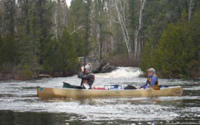
Friends of Wabakimi (FOW) proposes to fill gaps in our knowledge of Boreal Caribou presence and behavior, especially calving, on wilderness Crown lands within a 2.6m hectare part of the Brightsand and Nipigon Ranges that lacks recent geographically-specific monitoring data. FOW will seek to reduce anthropogenic disturbance, informed by this new data. The project is citizen science-based, engaging many wilderness canoeists. FOW will achieve broad outreach, using its powerful communication platform to publish results and recommendations. FOW will spearhead future citizen monitoring in this area. The project proposes 22 expeditions over 4 years, with some 88 experienced canoeists heading out in the Crown lands of the Wabakimi Area to investigate signs (hopefully will also catch sight) of Boreal Caribou presence and behavior, especially calving areas. The Wabakimi Area is near the current southern boundary of the continuous range of Boreal Caribou, and is regarded as a threatened area where the caribou population might not be sustainable. Such citizen research has been very effective in other fields, such as bird surveys. The grant will enable FOW to manage the project, and to provide valuable financial awards to incentivize expedition participants. FOW will seek to reduce human disturbance to Boreal Caribou through extensive outreach directly to its members and other wilderness users, and indirectly through its public comments to Ontario government agencies. Our FOW grant proposal was submitted on Sept. 23rd (before the Sept. 28th deadline)
0 Comments
By Gary Rinne, TBNewswatch.com 5/10/2022
THUNDER BAY — Friends of Wabakimi, a 250-member group of wilderness paddlers and recreational businesses, is lobbying for the preservation of new areas adjacent to the large wilderness park northwest of Lake Nipigon. On Victoria Day weekend, several members will embark on an eight-day canoe trip to gather information they hope will support their call for expanded protections in the forest just to the east of the 9,000-square-kilometre park. The expedition is a partnership with Ontario Nature, which plans to conduct a simultaneous survey of breeding birds in the area. Vern Fish of Waterloo, Iowa is the president of Friends of Wabakimi. He says the group has participated in the Ontario government's planning process for the Wabadowgang Noopming Forest in the Armstrong area. It's proposed four new Conservation Reserves and limitations on planned logging roads within a designated woodland caribou special area of concern. "We've identified some areas where we just feel they're better as protected areas rather than active logging areas. We've submitted those comments under phase three of the planning process," Fish told TBnewswatch. He said the upcoming canoe trip will give FOW a chance to paddle and document the waterways in what's known as the D'Alton Block, where there's an unusually high concentration of interconnected small lakes. "This area has many historic canoe routes with stellar wilderness values," he said, adding that the group is excited to partner with Ontario Nature to promote greater habitat protection outside the park boundaries. "It's a former caribou habitat. There's a very nice chain of paddling lakes there. We feel it should have a greater level of protection. It doesn't necessarily have to be a provincial park. It could be a conservation reserve or some other level of protection...This trip is kind of a way to wave the flag and to say 'this area is important.' " Fish said there's currently some logging in the vicinity of the chain of lakes, and that the operators are required to maintain a buffer. "I believe they're doing that. I have no reason to believe they're not doing that," he commented. For Kristen Setala, the upcoming trip is also an opportunity for her to gather data for Ontario's third Breeding Bird Atlas. Setala is the Community Science intern for Ontario Nature, based in Thunder Bay. According to Ontario Nature, habitat loss is the greatest threat to breeding birds in Canada. Setala's work involves mapping their distribution and relative abundance across Northern Ontario. "This trip is a great demonstration or combining efforts and resources for a common goal of protecting natural spaces and species," she said. It's just one of many similar birding expeditions happening this summer across Ontario. The Atlas-3 project will continue until 2025. Last year alone, more than 1,000 volunteers participated. About the Author: Gary Rinne Born and raised in Thunder Bay, Gary started part-time at Tbnewswatch in 2016 after retiring from the CBC The Friends of Wabakimi (FOW) has proposed four new Conservation Reserves and limitations on planned logging roads with our formal comments for the Wabadowgang Noopming (W.N.) Forest ten year plan (2023 to 2033). These four areas are closely proximate to Wabakimi Provincial Park and within the woodland caribou special area of concern. The FOW also clarified that Trail Lake (aka Tamarack Lake) Road should remain undeveloped so as to not cause increased pressure onsensitive caribou areas in Wabakimi Provincial Park’s SE corner.
The FOW represents wilderness paddlers and recreational businesses with a current membership of over 250 who have an interest in the Greater Wabakimi Area. The FOW is the successor organization to The Wabakimi Project, which explored and mapped routes, portages and campsites over a fourteen year period. The maps for the W.N. Forest are contained in Wabakimi Canoe Routes Volume 5. FOW President Vern Fish is our representative on the W.P. Forest Local Citizens Committee (LCC). Previously, FOW met with the MNRF and their consultants. Of significance is Ontario’s Crown Land Use Policy Atlas Policy (CLUPA) Report G2616: Caribou Lake / Wabakimi, adopted in 2006, which states, “The primary use for this area will be commercial tourism. Extractive activities such as timber harvesting, while growing in importance, will remain secondary. Road access will be managed to maintain commercial tourism and fish and wildlife habitat. Land use conflicts will be resolved recognizing the importance of commercial recreation in the area.” Proposed Conservation Reserves While creation of new Conservation Reserves is outside the purview of the Ministry of Natural Resources Forestry’s (MNRF) forest planning process; it is within the broad responsibilities of the MNRF generally.
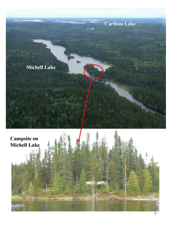
The D’Alton Block has an unusual high concentration of interconnected small lakes and rivers. It has been documented as historical caribou habitat and migration corridors. There are several valuable remote tourism outposts scattered across the “block”. This tangle of lakes has the potential to be enhanced for recreational canoeing and creates opportunities for canoe outfitting for the Whitesands community. Currently, canoeing access to the D’Alton Block is limited to portaging in from Caribou Lake. If the existing Big Lake Road were opened to recreational use up to the stream crossing just south of Big Lake, another route would be available to paddlers. This limited access would still maintain the wilderness character of the outpost cabins. It would also help reduce canoeing pressure on caribou calving on Caribou Lake in May and June. 4. Doe-Fawn Lake Complex – This area is located north and northeast of Collins. It is bounded on the south by the CNR Line, on the west and north by Wabakimi Park and on the east by Fawn and Doe Lakes. This area features shallow soils and is important currently used year-round caribou habitat. This small but important area deserves status as a Conservation Reserve to protect this caribou habitat. Eliminating or limiting road access and designating the area west of Doe and Fawn Lakes as a Conservation Reserve will accomplish both of these goals. Roads inside of CLUPA G2616. We are recommending some areas within CLUPA G2616 for Conservation Reserve status. That designation lies outside of the scope of the forest management planning process (FMP). However, it does lie within the responsibilities of Ontario’s Ministry of Natural Resources and Forestry (MNRF), and this is a Crown FMU. The Crown Forest Sustainability Act (CFSA) makes it clear that the Minister shall not sign any FMP that is not sustainable for all forest values. So, this draft FMP can, and should:
Of particular importance for lowest possible grade, temporary (perhaps winter) roads are:
These roads should be winter roads… or left just in the current state to keep open the possibility of increased formal protection of the caribou habitat and remote recreational experience. A Sense of Wilderness According to Vern Fish, FOW President, “Our goal is to maintain a sense of wilderness in key parts of this forest… Wabakimi has important values to be preserved. Our FOW priorities and concerns are: -- Ecological integrity and sustainability -- Maintaining a healthy and sustainable woodland caribou population -- Protect lakes that support Lake Trout -- Protect exceptional recreation and tourism values adjacent to Wabakimi Park: *Maintain existing and potential wilderness tourism business opportunities *Preserve historical canoe routes that directly or indirectly connect to adjacent provincial parks.” “We do understand the need for economic benefit to Whitesand First Nation, and Armstrong. We believe that the - above recommendations are consistent with long term sustainability for both the natural environment and local economy.” Contact: Vern Fish, FOW President at [email protected]
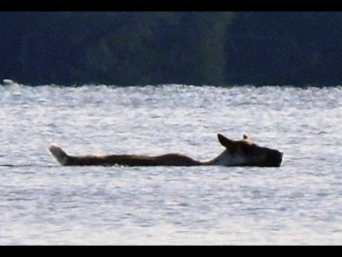
FOW President Vern Fish is in regular communications with W.P.P. Sup. Shannon Lawr and other park staff. Here's three items they shared from this week's discussions. Grey Ghosts of Wabakimi -- Woodland Caribou Flyer (open & download) What can you do to help? P lease do your part to help ensure that there will always be woodland caribou in the park: • Try to avoid camping/ using shore lunches on islands during the vulnerable calving period (May and June). • Use existing campsites • Stick to trails to reduce the overall footprint on the sensitive lichen-carpeted habitat. • Keep dogs on a leash • If you see a caribou, do not pursue it. Keep your distance and just observe. • If you see a caribou please take time to fill out the sightings chart. • Thanks! The caribou appreciate Fish for the Future: (Do's & Don'ts) open & download Wabakimi fishing is among the best in Ontario due to a well managed fishery and remote setting. Let’s help keep it this way for future generations. Catch & Release, Fish First Aid, Gear, Drastic Plastic iNaturalist-Ontario Shannon Walshe-W.P.P. Biologist-- says canoe trippers can contribute to flora and fauna information, monitoring, and protections by entering observations in iNaturalist. See her interview from last August. iNaturalist-Getting Started Video Tutorials Wabakimi Voices
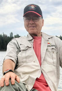
(Bruce Hyer is the longtime proprietor of the Wabakimi Canoe Outfitters and Ecolodge. His early efforts for creation of Wabakimi Provincial Park are chronicled in this chapter in “Islands of Hope” 1992. He previously served two terms as Member of Parliament and has been the Green Party candidate in the last two elections. Enjoy his recent slideshow. This interview was conducted by FOW Board Chair Dave McTeague.) First, this has been a tough year or more with the pandemic and border closures. How are you doing? Doing fine. I’ll be 75 in August, but I’m still clearing portage trails, guiding the odd trip, teaching whitewater, flying my float plane and building docks. I have three predictions, the Wabakimi ice will go out on May 10th, I’ll be paddling and clearing trails on May 11th, and the border will open with some conditions (vaccination/testing) no later than July 1. What were the dynamics that helped create Wabakimi Provincial Park in the first place? When I was living at Shawanabis Lake, I worked on this along with Don Plumridge, a fly-in operator, and the late Bruce Peterson who represented the World Wildlife Fund and Environment North. It was a hard sell. I thought it would take five years; it took twenty-five years. Nobody up here wanted it. Armstrong didn’t want it, the loggers and miners, the government, the Ministry of Natural Resources, and most of the First Nations didn’t want it. We made many trips to Ottawa and Toronto. You have to be persistent and play both softball and hardball. Since then most people locally and regionally have come to appreciate it. What dynamics drove the expansion of the park in 1995? I wrote a letter to the Natural Resources Minister Chris Hodgson about “postage stamp” Wabakimi Provincial Park, asking him to consider small expansions. All the values, biological and geophysical for which the park was originally created were left out. This led to the Wabakimi Park Boundary Committee. Dr. Peter Duinker (forestry professor) chaired this and came up with 43 watershed assessment units. So we had 43 little fights and assigned values to each one; forestry, mining, caribou, recreation, this list goes on…certain things just jumped out. Unfortunately, some of the controversial areas got left out, like the D’Alton and northern half of Caribou Lake areas. However, it was 90% a very good news story. Are we done with expansion of Wabakimi area parks and protected areas? What more is there to do? It’s not quite big enough; a few areas should be added. I recommend books by E.O. Wilson, one of them is “Half-Earth”. He says the only hope for the biosphere of the planet is to set aside half of all ecosystems on earth. Then we need to manage the other half better. What do you hope we can accomplish in this round of forest planning for the Wabadowgang Noopming (Armstrong) forest? On conservation efforts, sometimes we win, like with Wabakimi, but when it comes to forest management, we rarely win, we mostly postpone losing. We have worrisome forestry up here. It’s the orderly liquidation of the forest. Our forests are low on nutrients, productivity and diversity to begin with, and then you take half the biomass and ship it off, then you spray the other half with carcinogenic Roundup herbicide; it’s really not good. The D’Alton Lake area and the north half of Caribou Lake do need more protection. In theory we had that protection with the special land-use designation. But the government and the logging company say that was 20 years ago and “You don’t really mean that anymore do you?” Looks like it’s going to get logged. The only question is whether the logging roads will be permanent or temporary – so it can heal afterwards. This area is important for remote recreation and tourism, paddling and woodland caribou habitat. The primary reason I worked to create Wabakimi Provincial Park was to protect an ecosystem large enough to let fires burn, but mostly for the caribou. I think there are more woodland caribou now inside the park than fifty years ago: 300 to 500, that’s an educated guess. The reasons are: less aboriginal hunting and most of Wabakimi has moved into prime age for lichens. The caribou population is dependent on calving habitat, summer habitat, corridors and especially tree and ground lichens in the wintertime when that’s what they mostly eat. Those lichens take 40 to 60 years to grow. Outside the park they’re in deep trouble. The caribou have retreated on a line that’s virtually identical to roads, logging and human disturbance. Online is my master’s thesis looking at the effect of logging disturbance and the effects on caribou. {This Spring/early June. I plan to do some trail clearing. I made or found a lot of routes 40 years ago. We’re going to clear the Palisade River, from Burntrock Lake to Whitewater Lake, as well as the routes in the D’Alton Lake. (Wabadowgang Noopming forest). The end of May I want to run a (five-day) trip into D’Alton, Moonshine, Reef, Cumaway, Pawshowconk and Big River; to renew my notes and make sure the portages are open. So we’re always looking for volunteers. My main goal is to document the unique values that are in there so I can bring those back to the forestry group planning team. Plus I’m going to invite them on this trip.} Access issues: Talk about your concerns with road improvements and park access. I’m personally and professionally in a conflict of interest. The conservationist and wilderness lover in me would just like to assume Wabakimi was a huge secret and nobody knew about it. On the other hand I have bills, staff and certain number of clients I need to survive as a business person. And I really enjoy helping people who appreciate and respect real wilderness! Many people would love to be able to just drive to edge of the park and launch their canoe inexpensively and easily. The problem is some areas do not have high recreational potential. For example, there are some beautiful and small rivers, with not that many camp sites, no soil...it would be easy to overload it. Also the caribou utilize those areas winter and summer. It’s not just logging and roads that drives out caribou, but also too much human intervention. Moose are quite tolerant of human activity and tend to stay within a one km area. Caribou are genetically predisposed, if they’re unhappy, think nothing of moving thirty miles in a day and say we’re out of here. Also we still lack a park management plan. We were promised progress on this as far back as 1995, after the expansion and in the early 2000’s. Here we are decades later. We don’t need to manage the ecosystem and the caribou. We do need to manage humans. There are basically two landscapes for paddlers. High recreational intensive use areas that can soak up quite a few people, maintain ecosystem and quality of experience. For example, the north end of Caribou Lake has all those islands and points where you could wander around for a week, be quite happy and have a semi-wilderness experience. But some places near the park boundary are very sensitive. If ever in my lifetime, I’m hopeful we have some areas which are deliberately hard to access with limited number of permits. Then we can direct people to areas more capable for intensive paddling. Also, float planes can be used to spread the pressure around, so we don’t love it to death. (For example: Flying to the Palisade River and back to Little Caribou; or Allanwater or Flindt Rivers, and eight days loop back.) Unfortunately, people can camp wherever they want, so we have them camping on islands that the caribou use for calving. We’ve had a park since 1983 and the park still doesn’t say “do not camp on the small to medium sized islands on these lakes!” But I do, when I trip plan with people. What should be in a Park Management Plan that’s not currently addressed? Number one, protection of endangered species, woodland caribou and wolverines. Number two, a broad conservation objective which is intact ecosystems, no roads, logging, mining, hydro development, no new economic activities, except for some paddlers. And direct park access away from certain sensitive sites near the park edge. Don’t we already have that? Yes and no. At some point Wabakimi is going to be discovered and Friends of Wabakimi are helping to do that. At some point we’re going to be endangering some of those values; caribou, remoteness & wildness, with too much or inappropriate use in the wrong spots. We don’t have to manage wilderness, we do need to manage ourselves. We humans hate to say no to ourselves! I don’t think the whole five million acres are at risk, but there are some spots where it would be really easy to degrade the experience for people, but also put caribou and ecosystems at risk. Should the (1995 park) expansion area also have a wilderness classification? It doesn’t worry me. Wabakimi wouldn’t have been expanded as a “pure” wilderness. Very deliberately Don Plumridge and I encouraged the big addition to be a Natural Environment park. Right now it’s unclassified. A Natural Environment park is exactly the same as a wilderness park except that it allows some tourism and token moose hunting. While moose hunting doesn’t happen that much, it is very important to people in our region to have that available. A lot of people would be opposed to Wabakimi if tourism and hunting wasn’t allowed. (Also noted, there about twenty grandfathered outposts on some of the big lakes. The expanded park doesn’t affect treaty rights.) When the park was created, we agreed conservation was priority one. Priority two was job creation and economic benefit. If we’re going to hang on to protected areas, somehow we have to show some economic benefits to the local community. How could the recreation industry help? If people would invest to hire some locals, to clear portage trails or to guide. I’d love to see another canoe outfitter or two in Armstrong. I’m pretty much the only one. People need to invest in those jobs or we’re not going to be able to hang on to the protected areas we have. Populations are going up and we’re running out of wood and timber. The pressures will be there, not just to log the D’Alton area but, potentially to take a raw timber out of Wabakimi (P.P.) and they’d say there’s still 4.7 million acres. You’ve seen politics in the U.S. and the unthinkable happens. Unfortunately, the Ministry of Natural Resources puts forestry ahead of parks and protected areas. All of us vote with our wallets every day. I’ve seen a change, with how many people want a high quality experience, fly-in and maybe out also, so they can see a wilder part of the park. I’ve seen a change, possibly because of Covid. A lot of people, myself included, are rethinking our priorities in life, family, friends, nature. 90% of my clients have always been from the mid-western U.S. mostly. All of a sudden last summer, Toronto and Southern Ontario discovered us, Canadians discovering their own backyard! The Misehkow valley (South of the Albany River, North of W.P.P.) Should this area be considered for protected status? For sure! The obstacle on the Misehkow was its mineral potential, which is why it wasn’t added to the park. Iron Falls, half-way down there’s chrome potential. At one time there was opposition to more parks up here. Yes, this area should be part of the park or a conservation reserve which is almost better than a park, no logging, no roads, no hydroelectric development, no mining... and no bureaucrats! I think the best canoe trip in Ontario is the upper Albany River. From Lake St. Joseph down to Ft. Hope. Or a combination of the Misehkow and Albany rivers. The drawback is long flights in and out. I’ve done the Albany about 10 times, guided trips on it, but you need some whitewater skills. Lots of moose. Wabakimi was an ancestral lake 7,000 years ago. Up on the Albany River, the soils are deeper which produces big trees. I’ve paddled the MIsehkow four times, the last time three years ago. If you have a week to ten days, fly into Rockcliff Lake, go down the Misehkow to the Albany, what a trip!
Highlights! Review of last year. Successful Planes, Portages & Paddles fundraiser with W.P.P.; Membership up to 174 Active members and growing. Five webinars. Working to protect portages and habitat on the Wabadowgang Noopming Crown landsForest near Armstrong. New Board members elected. Expedition Committee to provide new trip log format soon. Cartography Committee starting up. Phil Cotton Legacy Award goes to Debbie Doyle-Sargent for her long efforts supporting The Wabakimi Project being our Fiscal Agent and filling our Canadian map store orders.
|
|||||||||||||
©2020 Friends of Wabakimi All Rights Reserved
